
Integrating and bolstering science to improve restoration outcomes
RiversEdge West collaborates with researchers across sectors to gather data and investigate applied questions that inform restoration objectives. Read more to learn about our programs to support tracking tamarisk beetles (Diorhabda spp.).
Tamarisk Beetle Data
From 2007-2025, RiversEdge West coordinated with partners to track the tamarisk beetles and created a map to document tamarisk beetle presence and absence across the West. Populations of tamarisk beetles have now established in much of the available habitat throughout the southwestern United States, except for parts of southern Arizona. We have worked with over 70 partners, with documented observations ranging from Chihuahua, Mexico to California, and up into Oregon, Idaho, Wyoming, and Kansas.
These data do not represent all locations where the tamarisk beetle may exist. However, they give a broad perspective of beetle establishment and dispersal, providing land managers with information that may help with their integrated pest management plans, restoration strategies, and funding opportunities. Interact with almost 20 years of tamarisk beetle data here or below.
The Future of the Beetle Map
Since 2007, RiversEdge West’s Annual Tamarisk Beetle Map has tracked the spread of tamarisk beetles across the Southwest. Thanks to data provided by hundreds of researchers, citizen scientists, and other partners, we achieved the original map goals of 1) tracking the tamarisk beetle’s expansion, 2) informing land manager and landowner decision-making for riparian vegetation, and 3) supporting biocontrol and tamarisk research needs.
Tamarisk beetles are now well-established in the Southwest. The Annual Tamarisk Beetle Map no longer captures the zones of beetle spread while ongoing research questions require more complex data than the presence/absence information provided by the map.
For these reasons, with the completion of the 2025 Tamarisk Beetle Map, we are pausing future map releases. Tamarisk beetle data can still be submitted via iNaturalist, CitSci, or tamariskbeetledata@riversedgewest.org. We will hold this data and keep an eye on tamarisk beetle developments should the need arise to begin producing an annual map again.
The most recent map with over 16,000 data points from 2007-2025 will remain available. Other aspects of our tamarisk beetle program are unchanged, including our online resources, workshops, conference sessions, and education and outreach. As a reminder, our Riparian Restoration Conference now alternates years with a workshop series across the Southwest. We will start planning our 2027 Workshop Series this summer. Here is an example of a Tamarisk Beetle Workshop we held in Phoenix in partnership with Arizona Department of Forestry and Fire Management.
Thank you to all our partners and data providers that have supported this project over the years. Together, we created a unique, landscape-scale biological control monitoring system that continues to serve as an incredible outreach and educational tool for biological control, invasive plant management, and river health.
Contribute your tamarisk beetle observations
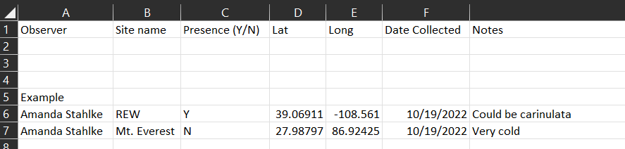
While annual map releases are on hold, community observations still matter. We will continue to store tamarisk beetle data. You can send tamarisk beetle presence or absence observations to tamariskbeetledata@riversedgewest.org, with a unique GPS point (latitude and longitude, as precise as possible) and date. You can use this excel template (previewed below) to help us keep data tidy. We will also accept shapefiles or kmz/kml. Tamarisk beetle data can also be submitted through iNaturalist and CitSci.
We also welcome any photos of tamarisk, defoliation or refoliation, beetles, or what's coming in underneath that you'd like to share.
How to monitor tamarisk beetle populations and impact
In collaboration with the Colorado Department of Agriculture Palisade Insectary and University of California Santa Barbara Marine Science Institute, RiversEdge West formed the Tamarisk Beetle Monitoring Program in 2007 to develop a rapid assessment protocol. The how-to video below outlines how anyone can monitor for tamarisk beetles. The datasheet described to record tamarisk condition and insect abundance can be found here. You can also read and use the Colorado Department of Agriculture, Palisade Insectary Tamarisk Biocontrol Monitoring Protocol, which includes understory plant community composition monitoring.